Hello,
We’ve just completed two official kelp site studies and had our first whale encounter while underway. I’m happy to report that we’re settling into a good rhythm with data collection. There are still some rough patches I’m working on to improve efficiency, but I’m proud of what we’ve accomplished in such a short time.
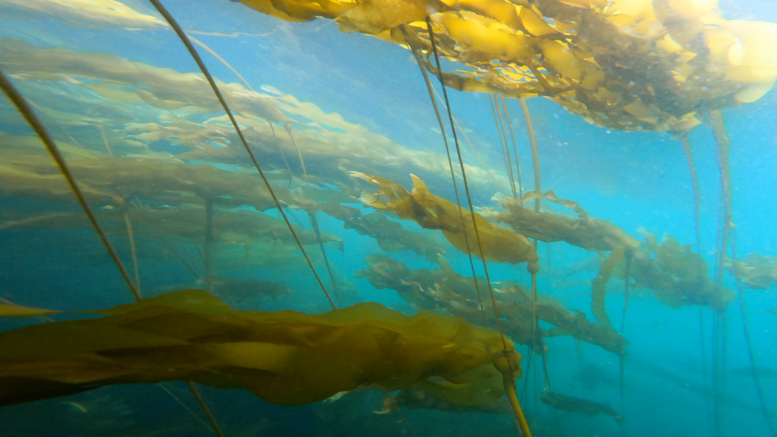
Our first kelp site study was at False Narrows on May 12. Though the wind was blowing steadily, it was a beautiful, sunny day. This was the first time we truly tested both the quadrat and the drone in the field. The quadrat, which Mike and Mark built back in Victoria, performed amazingly. We deployed it 11 times, collecting excellent downward-facing footage of the substrate and horizontal footage that captured the landscape of the kelp forest. Mike did a great job navigating us to each drop point and holding position in the current while I recorded data, checked the cameras, and deployed the gear.
The drone was also a big success. Despite wind speeds of 10 knots with gusts up to 15, we decided to go ahead with the flight. Since many of our future sites will likely have similar conditions, it was important to see how the drone handled it. I had pre-mapped a transect over the kelp bed, and after making a few adjustments on site, we flew it. The drone performed beautifully, stable, accurate, and steady in the wind. It gave us great aerial footage of the bed.
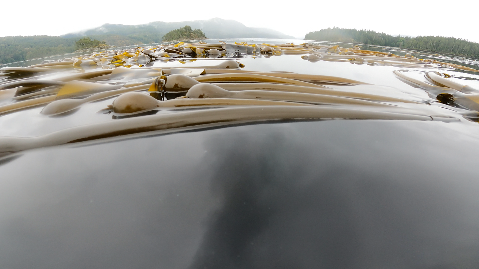
Yesterday, we conducted another kelp survey in Kanish Bay. This site was larger than False Narrows, so we aimed for around 20 quadrat drops. We also deployed the drone and a CTD sensor, which measures conductivity, temperature, and depth. Things were going well until the 17th quadrat drop, when our horizontal-facing GoPro snapped off and disappeared into the depths of the kelp forest. Jennifer and I tried to recover it by snorkeling and diving, but unfortunately, we couldn’t find it. Thankfully, we still had the downward-facing GoPro footage, the drone footage, and the CTD cast, so we didn’t lose everything.
Today, we’re heading to a smaller site in the Octopus Islands. Given the size, we likely won’t do as many drops as yesterday. Tomorrow, we’ll continue our surveys in Owen Bay, which is just around the corner.
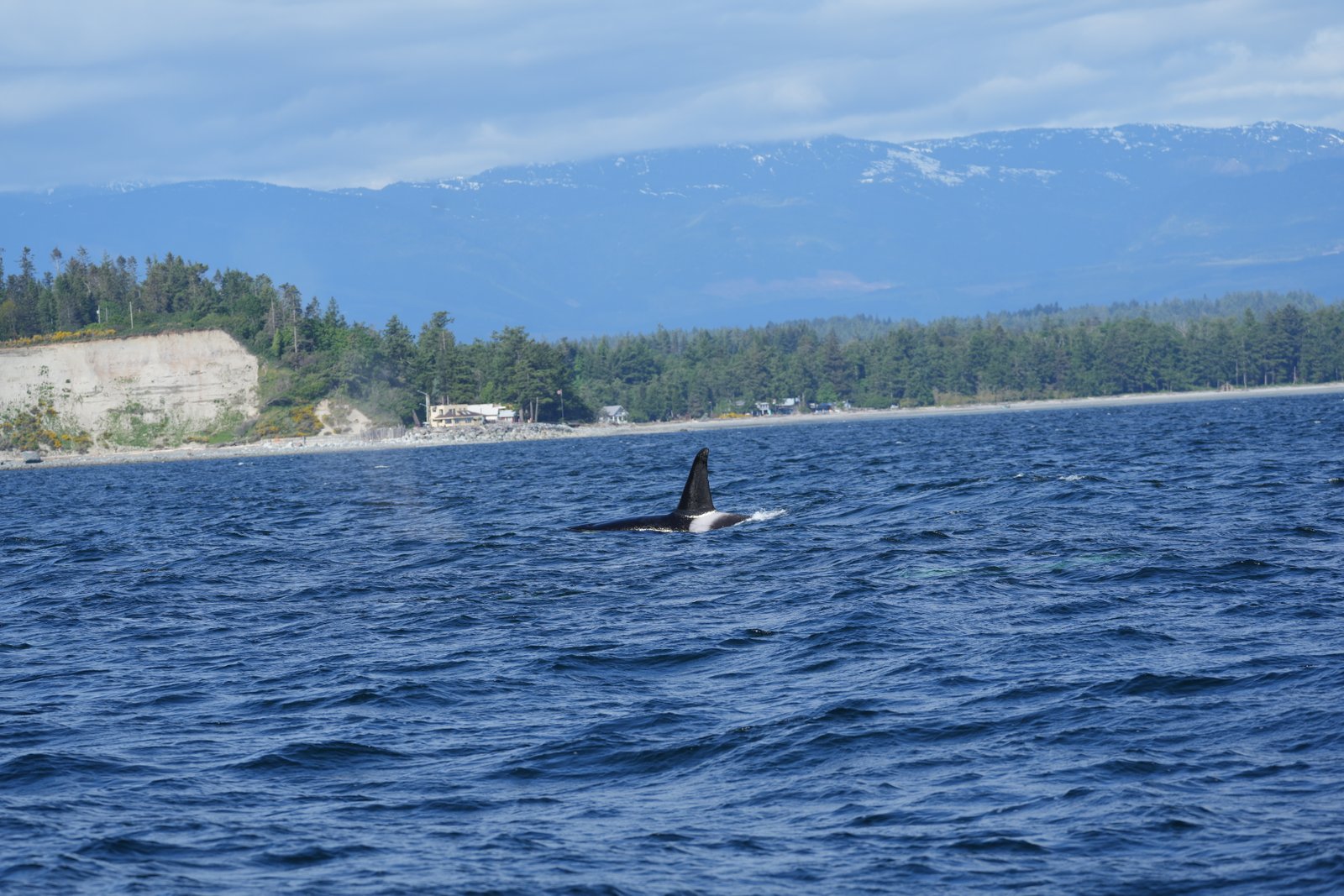
On May 14, we had our first whale encounter. We saw a large pod of orcas, about eleven in total, including a very playful calf that was tail slapping and head lobbing around its mother. As soon as we spotted the first fin, everyone sprang into action. We grabbed the notebook and the camera to document identifying features. For orcas, that includes dorsal fin photos, saddle patch images, and footage of their eye patches. The waves made it a bit challenging to get sharp shots, but we managed to capture quite a few good ones. I’ll be sharing this information with BC Whales, North Coast Cetacean Society, an incredible organization doing important whale research and conservation work here in British Columbia.
So far, the science has been extremely busy but incredibly rewarding. I’m constantly refining my methods to make data collection as clear and efficient as possible. I feel very lucky to be doing this research and to have such an amazing crew supporting me every step of the way.
Now I’m off to the Octopus Islands kelp site to collect more data, and probably get a little wet in the rain.
From the field,
Grace