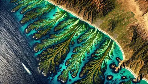
Satellite imagery refers to images of Earth or other planets captured by imaging satellites orbiting in space. These images are collected using sensors on satellites that capture various types of data in different spectral bands, such as visible light, infrared, and radar. Satellite imagery is a powerful tool for understanding large-scale patterns and changes on the planet and is widely used in fields such as meteorology, environmental science, agriculture, defense, and urban planning.
Types of Satellite Imagery
- Optical Imagery: Captures images in visible and near-visible wavelengths, similar to a photograph, but from high altitudes. It’s ideal for observing features like vegetation, bodies of water, and urban areas.
- Infrared Imagery: Used to detect heat and temperature variations, which is especially useful in monitoring vegetation health, soil moisture, water bodies, and weather systems.
- Radar Imagery (SAR - Synthetic Aperture Radar): Uses radio waves to create images, allowing for cloud-penetrating, day-and-night imaging. SAR is valuable for studying terrain, vegetation, and monitoring changes in the Earth’s surface.
- Multispectral and Hyperspectral Imagery: Collects data across multiple wavelengths beyond visible light, providing detailed information for studying vegetation, soil, water, minerals, and urban landscapes.
Applications of Satellite Imagery
- Environmental Monitoring: Tracking deforestation, glacier retreat, wildfires, and pollution.
- Weather Forecasting: Observing cloud patterns, storm systems, and climate phenomena.
- Agriculture: Assessing crop health, soil quality, and planning irrigation.
- Urban Planning: Mapping land use, infrastructure development, and urban expansion.
- Disaster Response: Assessing damage after earthquakes, floods, hurricanes, and tsunamis for planning rescue and recovery operations.
How Satellite Imagery is Accessed
Satellite imagery can be obtained from various sources, including government space agencies (such as NASA and ESA), private companies, and open data platforms. Some data is free, especially for scientific and educational purposes, while higher-resolution images may require a purchase or subscription.