Our plan to stay a few more days at Herschel Island in Pauline Cove changed quickly this morning. The predicted calm weather will end in less than 24 hours, about as much time as it will take One Ocean and crew to sail to Tuktoyaktuk, a very safe and secure port from wind and ice. We weighed anchor at 1030 and are now heading west along the Canadian Arctic shore.
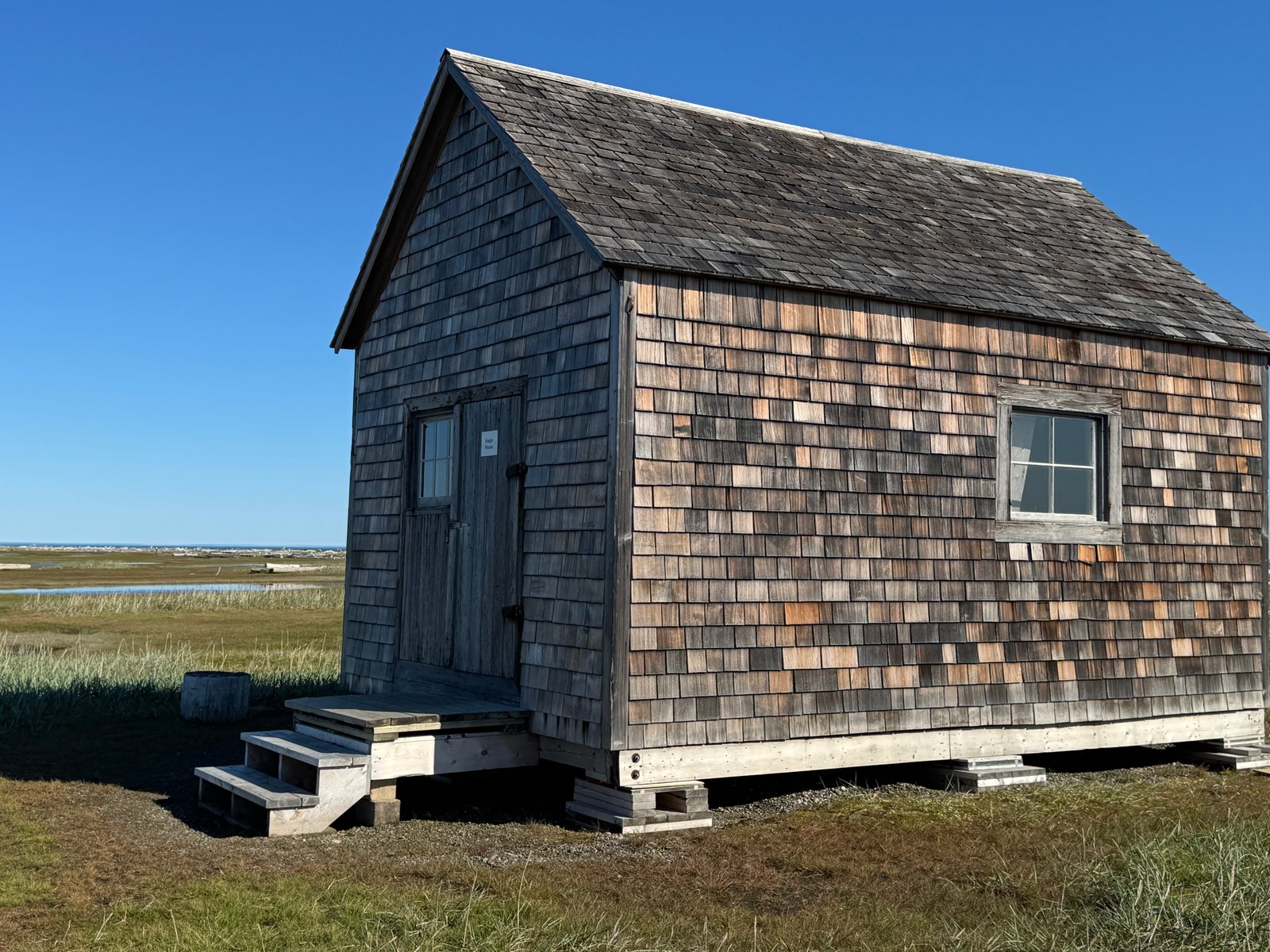
Observations (notes and memories) from Herschel Island, 15 years after our Ocean Watch visit, the melting permafrost has dramatically changed the harbor and surrounding landscape. Sea level rise is noticeable, community buildings are now on raised ‘foundations’ – mostly wooden blocks.
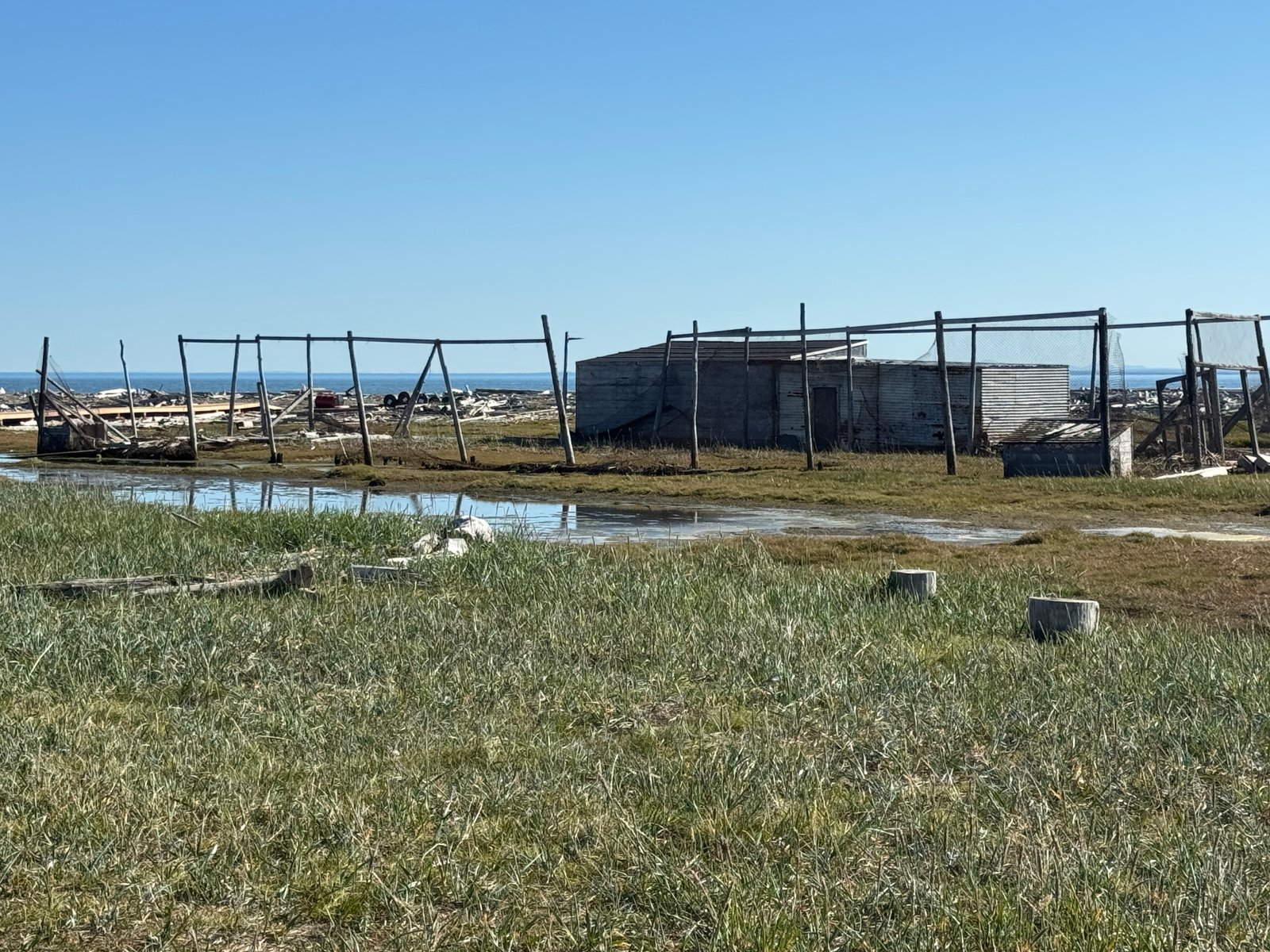
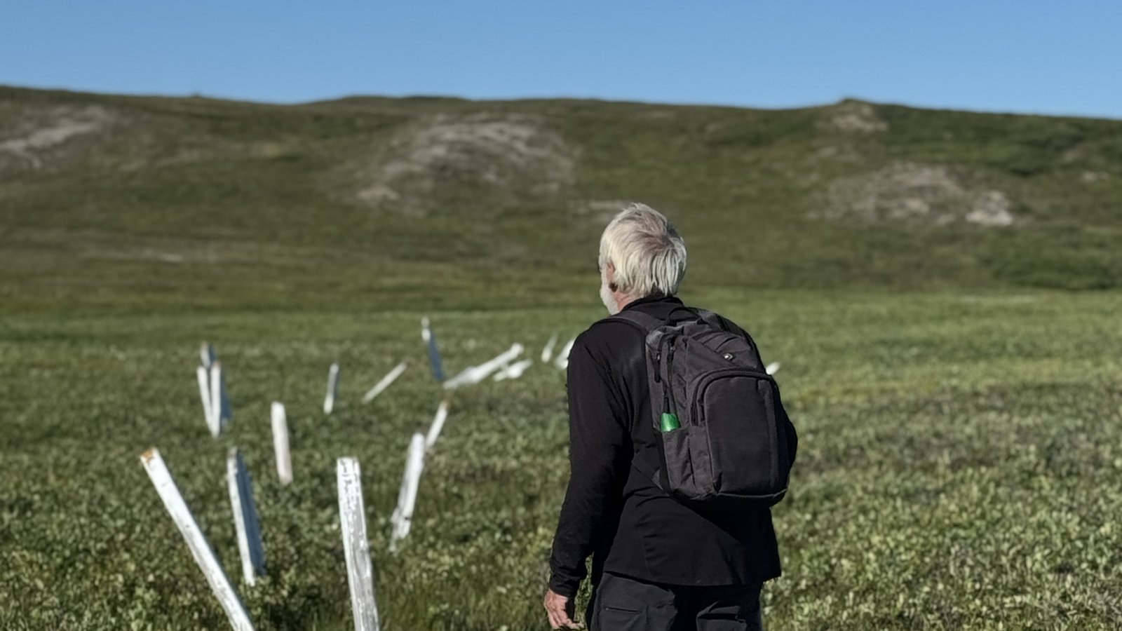
Surrounding areas that were dry grassland 15 years ago are now either marshy, spongy wetlands or altogether gone.
The lone gravel landing strip still exists at the very edge of the Beaufort Sea – water paralleling the length on one side, logs and sand on the other. A raised wooden walkway connects the landing strip to the small row of houses. It is still a very beautiful and protected harbor. The rolling hills surrounding the cove look green and soft – and completely devoid of vertical trees. Where those hills meet the shore major erosion is evident, lots of it.
Dave Logan and I recalled walking over a decade ago from the houses to a small graveyard of young whalers making Herschel their last home – most markers indicating 18 – 25 year old ‘whalers’ leaving the planet in the late fall or winter months.
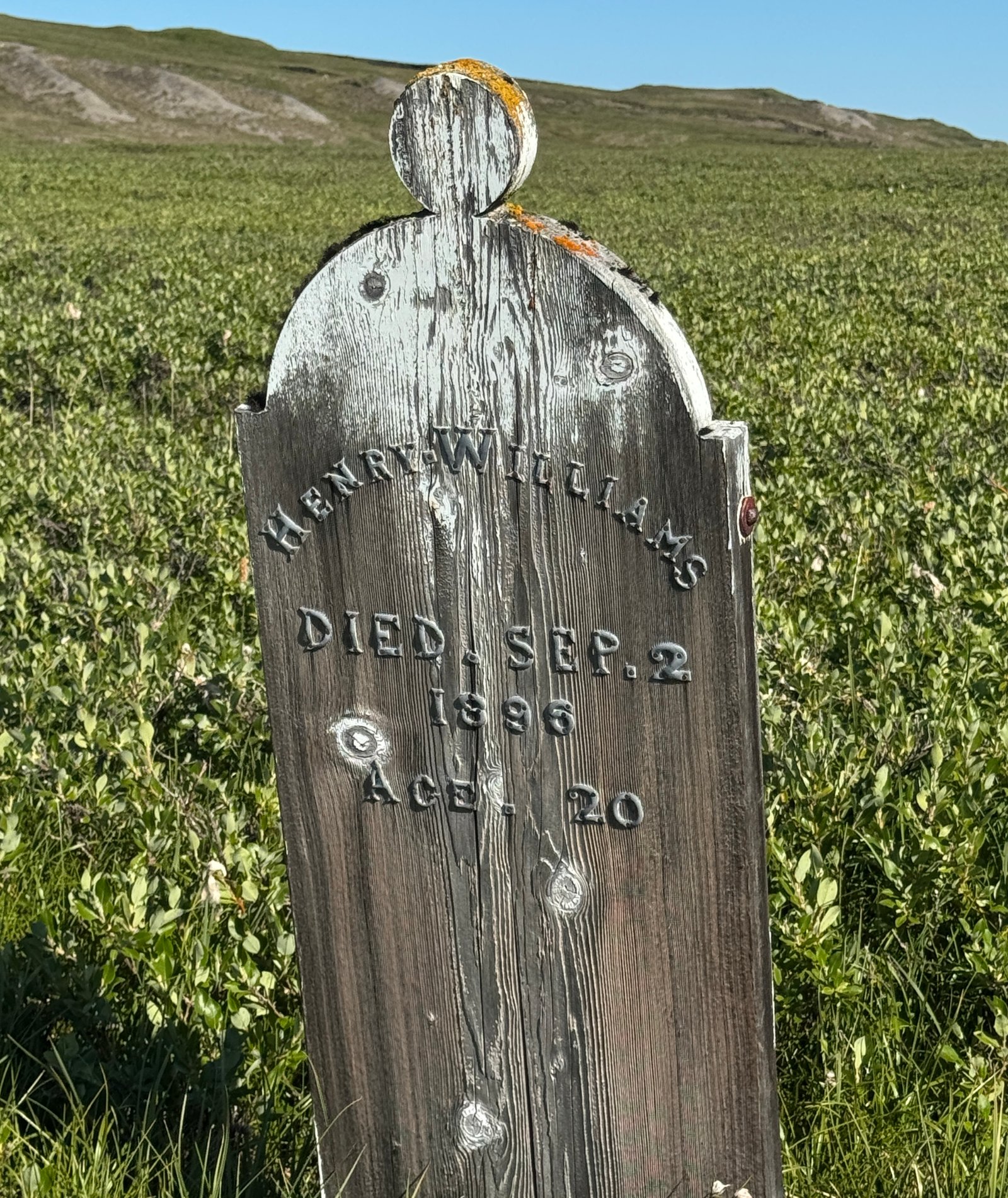
And then I’m reminded that the graves and markers were moved some years ago as the area became wet. Jennifer and I retraced that walk of 15 years ago. The markers still exist although some haven’t survived the weather or the move - and they are wet. The ground is now covered with low growth looking like salal with a few small flowering plants poking up between more hardy growth. If you are a plant in this environment there isn’t much available time between sprout and flowering, so you’d better be hardy and in a hurry. The day of our walk was perfect for growing, air temperature of 64F, clear skies and not enough wind to discourage any mosquitos.
We weren’t the only boat in the harbor. Several small craft brought Inuit families and fishing nets from communities several hours away to harvest a run of Arctic Char or Dolly Varden known to frequent the harbor at this time. Sometimes other wildlife unexpectedly appears. We had just set our anchor when several shots were fired. Apparently, a reindeer had found itself along the beach not far from us. It was next to a sandy hillside and obviously wasn’t expecting armed company. Not much time elapsed between shots, harvesting/dressing and transport (by boat) back to camp. We ate chicken on board that evening.
Herschel Island has a very interesting history and has long been a safe harbor for hunters, travelers and explorers. It is named for Sir John Herschel, an eminent astronomer and proponent of the British Terrestrial Magnetism/Magnetic Crusade of the early 1800, who teamed up with Joseph Banks and John Barrow and helped to launch an international (British) effort to chart, record and label the planet – its geography, natural history, zoology and botany. This set in motion the “Golden Period of Exploration,” motivated primarily by science rather than military glory. The effort to find a northern connection from the Atlantic to the Pacific was launched. Barrow convinced the British Royal Society to offer a prize of $20,000 for discovering the NW Passage. At the same time, measuring and recording global magnetic variations from the North Pole to the South Pole would greatly enhance navigation and safety.
All of that explains why every passage, strait, port and land mass on Arctic and Antarctic maps and charts are names of British explorers, politicians, scientists, ships and friends or families. Amundsen Gulf, named for Roald Amundsen, the most accomplished polar explorer and the first to transit the NW Passage by sea 1907, also the first man to trek to the South Pole - heads the long list of notable explorers. There are interesting examples: Queen Maud Gulf, King William Island, Gulf of Boothia (the only peninsula in the world named after a brand of Gin), Bellot Strait (“discovered” in 1858, named after discoverer Joseph Rene Bellot, and for good measure “Astronomical Society Island” followed by Royal Geographic Society Island. Parry, Melville, Albert Edward and Committee Bay shouldn’t be overlooked. Thanks to the Brits, we’ve no shortage of named passages and bays for the next 1200nm or so. For the record, Inuit arctic history is rich with names and place descriptions of this same territory, which, had they asked, could have saved the British cartographers some time and trouble.
I can only assume that Tuktoyuktuk resisted the pressure to be renamed by explorers from somewhere else but I’ll make it a point to find out. Meantime, the level of activity on the good ship One Ocean is significant. Writing, planning, educating, fixing something, laundry, engine checks, cooking, watching and talking would cover most of it. Right now, Tuk is 88nm away, Cape Parry and ice 200nm away and an evening meal (oven roasted chicken) 2 hours away. I’m happy to report all well aboard Oo.