On the days when ice allows us to move forward, time travel comes the closest to expressing what we are really feeling. The passages we are traversing have been used by hardy souls for hundreds – maybe thousands -of years. Most of what we see has spent eons under ice. As the ice slowly shifted or melted land appeared. Higher land masses poked their peaks out of the receding ice. As the weight of the ice decreased the land rebounded, defining islands, waterways and the passages we are using today. Enormous boulders were left on ridges and hilltops as the land rose up and tundra melted away. From a distance those rocks look impossibly out of place, sentries guarding ridgetops ready to defend the high ground. Are they really stone? Do they move when we aren’t looking . . . what are they doing there? Are ‘they’ just watching us or do they have a purpose? Turns out some of them do.
In the early 1800s the British were intent on finding the magnetic north pole, an extremely important reference point for Northern Hemisphere exploration, mapping and commerce. The raising of the Union Flag and the annexing of the North Magnetic Pole in the name of Great Britain and King William IV became the focus of the British Admiralty and led to many organized land and sea efforts to survey and map everything we are seeing. Most of the accounts we’ve read of these efforts included more failures than successes, long periods of being frozen or smashed in ‘towering’ ice formations, temperatures 40 degrees or more below zero, darkness and death! Very few of the early efforts were successful but the Brits just kept trying.
Special thanks to close friend, sailor, traveler and arctic history buff Tom Hoymer, who spent a few years of his life up here (a Norwegian, not a Brit) and Andy Szurek, traveler, writer and Fur Islander - both of whom conspired to make sure we had the right reference material on board for this voyage. An excellent book by Michael Palin, “Erebus,” chronicles account after tragic account of these early and later efforts and should be required reading for anyone interested in this stuff.
James Ross Clark “found” the Magnetic North Pole in 1831. When holding a compass level in the northern hemisphere the needle swings to geomagnetic north unless you happen to be standing at the very location of geomagnetic north, in which case the needle doesn’t know where to point so the tip of the needle actually dips down, a magnetic attraction to what’s directly under it. James pinpointed magnetic north at 89 degrees, 59 minutes – very close to exact at that date. Finding the proverbial needle in a haystack would have been easier. Palin’s book is a great place to start.
I didn’t know much about this dip behavior until I sailed south many years ago to a point where the magnetic South pole influenced my compass. As I got closer the compass card dipped so far it no longer worked as a compass, that is, it wouldn’t swing and point reliably. Not really a problem in today’s world of electronic gizmos but then it was a bit of an issue, I needed my compass to work.
Clark wasn’t finished with his work. Another expedition was launched in an attempt to find a way through the Northwest Passage. Clark was nominated by the British Admiralty to help with the effort. Funding then (as now) was difficult to secure but Clark had a good friend in the Gin distilling business, Felix Booth, who willingly invested a considerable amount of money to outfit Clark’s vessel of choice. Support from Booth led to his gin brand earning naming rights to a couple of important geographic points up here. Boothia Peninsula on the eastern side of the NW Passage and Booth Island, our beautiful anchor spot two nights ago.
Clark also left his signature on Booth Island. We spent a few days anchored in the sheltered Summer’s Harbor and one afternoon Jenn and I geared up with bear spray, shotgun and radio and went ashore to hike up some gentle hills to have a look around from higher ground.
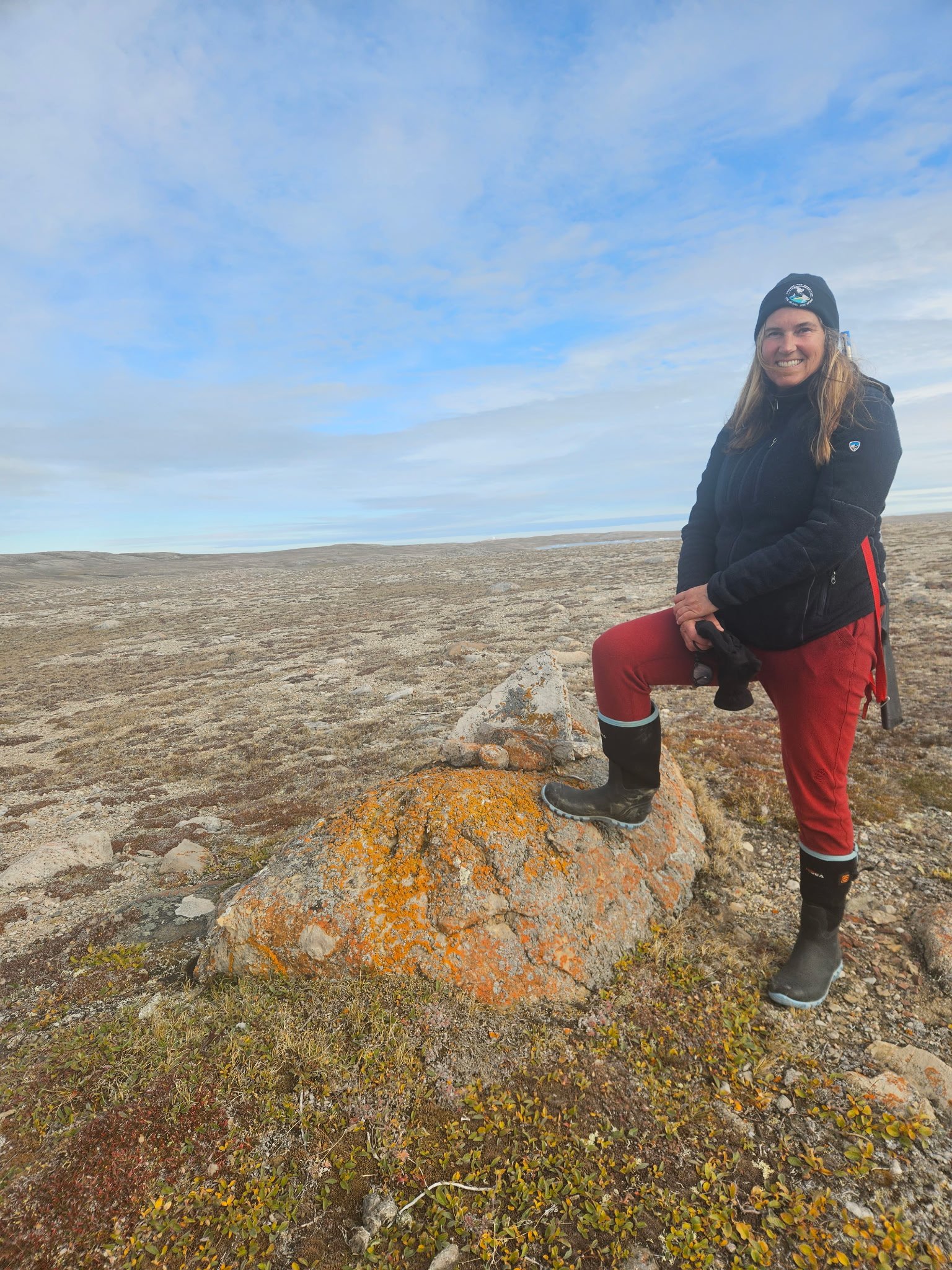
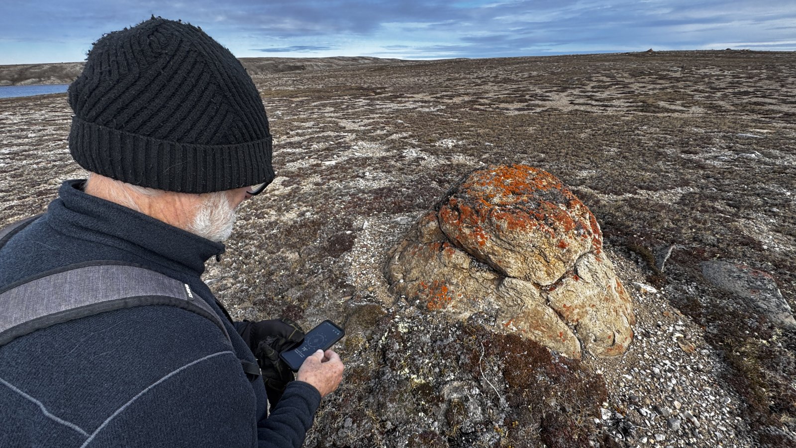
We were walking amongst many of those large ‘sentry’ rocks scattered over the territory. Massive things, sitting on top of hills, looking very out of place when surrounded by gently slopping gravel and tundra cover.
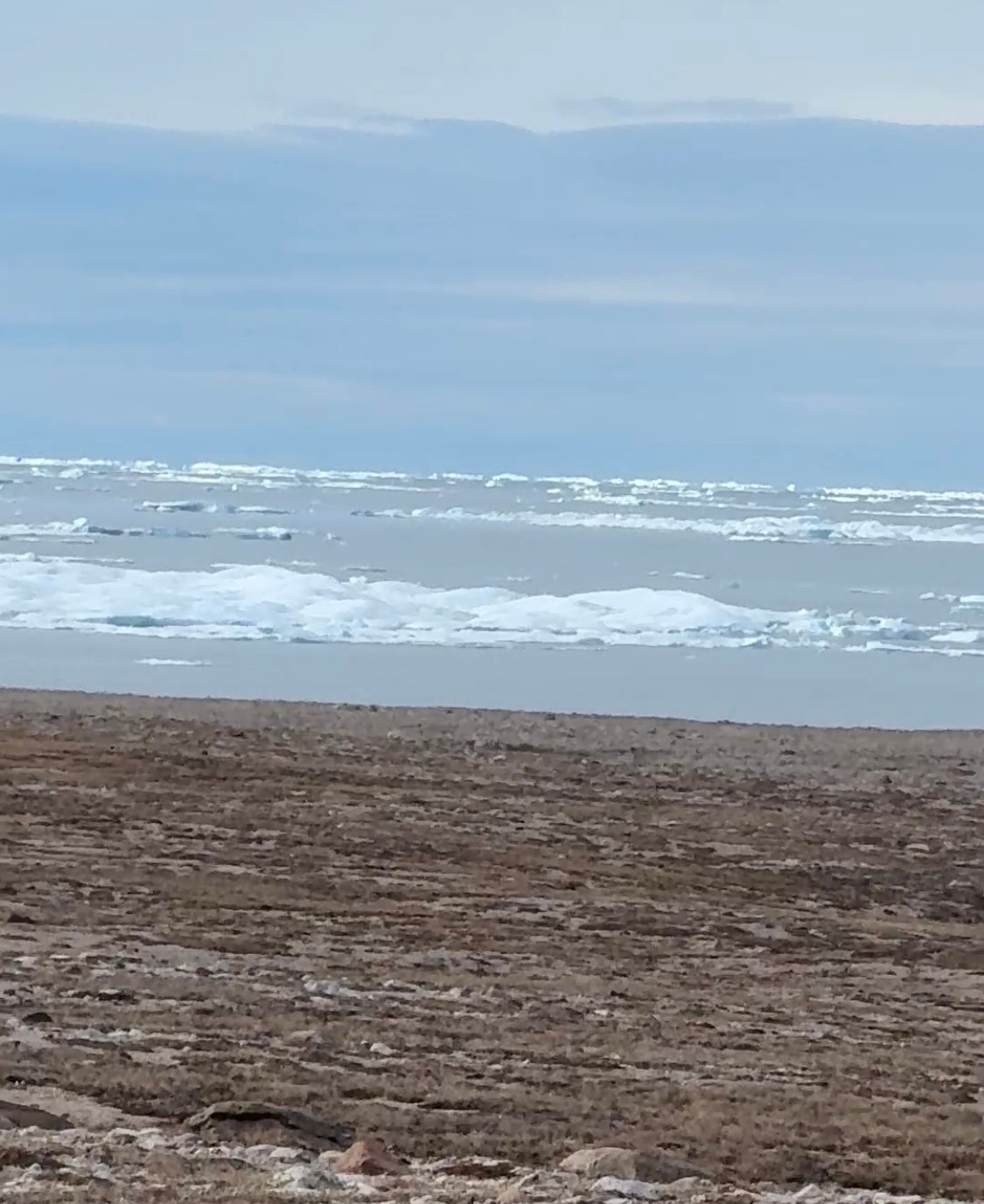
From the top of the hill we could see the water surrounding Booth. Our harbor was full of ice which meant the next few days of navigating our way east was going to be difficult.
We also noticed a peculiar coincidence of how some of the big rocks on top of the hill seemed to be placed. One central behemoth, round and smooth with no vegetation growing around its perimeter, seemed like it had some purpose. Several others, a few hundred yards away also seemed oddly placed and important.
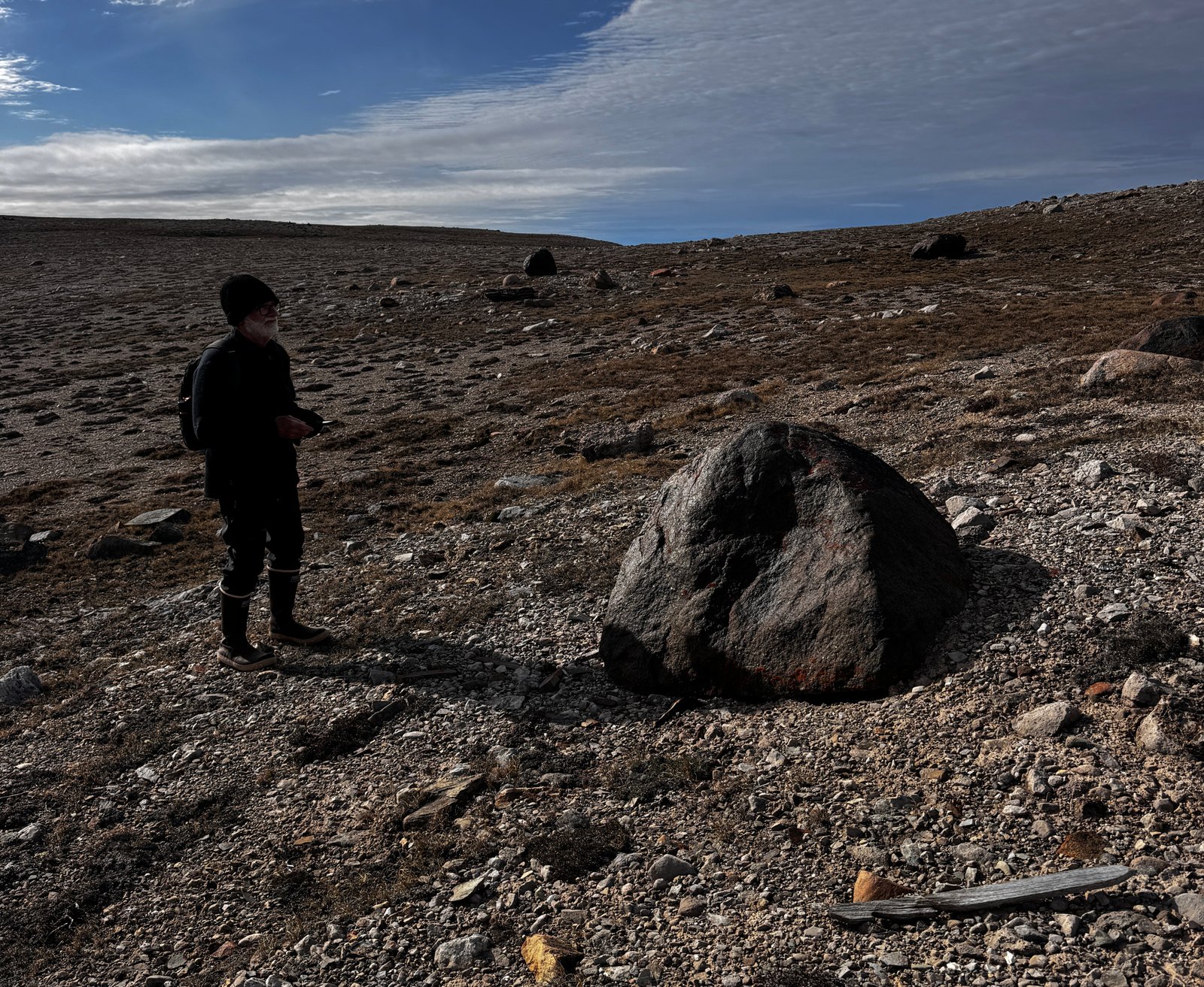
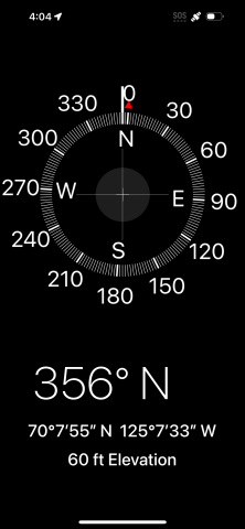
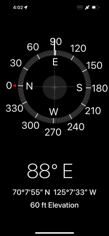
On impulse I pulled the compass app open on my phone and held it over the big mound in front of me. The compass didn’t know what to do, swinging wildly through 180 degrees. I backed away and then tried to take a bearing from that rock to the next one on a ridge, then doing the same thing with others along the ridge. North, South, East and West were described, no doubt, although we weren’t sure how any of this could be possible. Given the location of the island, the surrounding terrain and the size of the rocks we were certain they weren’t humanly placed. Coincidence we guessed, but still puzzling. As we walked back to One Ocean we took another transit sight from the ‘big central rock’ to points into the harbor – a perfect east/west line, well marked by intermediate rocks of a different color. North/south line is just as accurate. A perfect compass on top of the hill.
It didn’t occur to us until we were safely aboard One Ocean that maybe, just maybe, James Ross hid a cache of his sponsor’s Gin somewhere on top of that hill and marked it with clues we missed. Stranger things have happened. The history of this place is fascinating and we are fortunate and happy to travel in the footsteps of so many others.